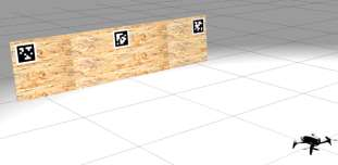
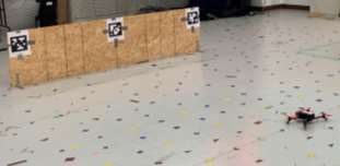
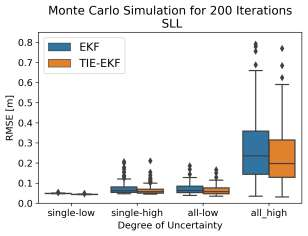
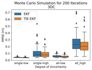
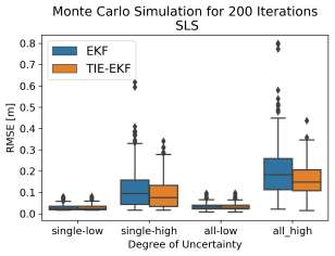
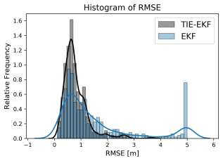
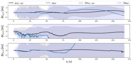
Autonomous mobile robots, including unmanned aerial vehicles (UAVs), have received significant attention for their applications in construction. These platforms have great potential to automate and enhance the quality and frequency of the required data for many tasks such as construction schedule updating, inspections, and monitoring. Robust localization is a critical enabler for reliable deployments of autonomous robotic platforms. Automated robotic solutions rely mainly on the global positioning system (GPS) for outdoor localization. However, GPS signals are denied indoors, and pre-built environment maps are often used for indoor localization. This entails generating high-quality maps by teleoperating the mobile robot in the environment. Not only is this approach time-consuming and tedious, but it also is unreliable in indoor construction settings. Layout changes with construction progress, requiring frequent mapping sessions to support autonomous missions. Moreover, the effectiveness of vision-based solutions relying on visual features is highly impacted in low texture and repetitive areas on site. To address these challenges, we previously proposed a low-cost, lightweight tag-based visual-inertial localization method using AprilTags. Tags, in this method, are paper printable landmarks with known sizes and locations, representing the environment's quasi-map. Since tag placement/replacement is a manual process, it is subject to human errors. In this work, we study the impact of human error in the manual tag installation process and propose a stochastic approach to account for this uncertainty using the Lie group theory. Employing Monte Carlo simulation, we experimentally show that the proposed stochastic model incorporated in our on-manifold formulation improves the robustness and accuracy of tag-based localization against inevitable imperfections in manual tag installation on site.
翻译:自动移动机器人,包括无人驾驶飞行器,在建筑中的应用受到高度关注,这些平台极有可能使许多任务,如施工时间表更新、检查和监测等,所需的数据自动化并提高其质量和频率,这些平台具有巨大潜力,可以使自动化移动机器人的自我定位是可靠部署自主机器人平台的关键助力。自动机器人解决方案主要依靠全球定位系统(GPS)进行户外本地化。然而,室内拒绝全球定位系统信号,而内部本地化经常使用预先制作的环境图。这意味着通过在环境中远程操作移动机器人,生成高质量的地图。这种方法不仅耗时和乏味,而且室内建筑环境中也不可靠。根据施工进度进行布局调整,需要经常的绘图会支持自主任务。此外,基于视觉特征的基于愿景的解决方案的有效性在低质素度和现场重复地区受到严重影响。为了应对这些挑战,我们先前曾提议使用ApretTags的低成本、轻量标签、基于本地本地本地化的方法。在这种方法中,我们使用的是智能成本、本地化的内值,在这种方法中,我们使用的是智能的内值标签。


