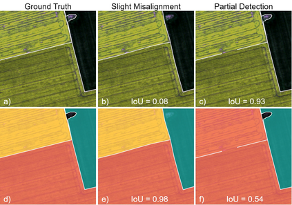
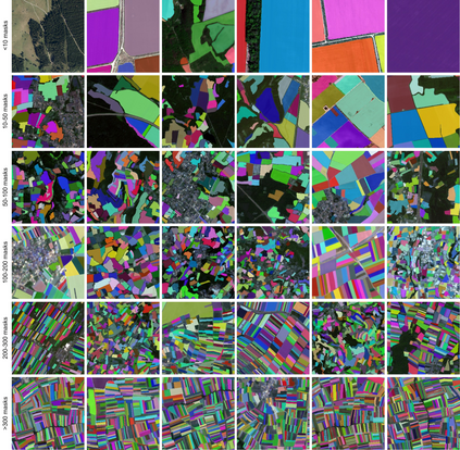
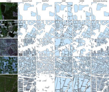
The accurate delineation of agricultural field boundaries from satellite imagery is vital for land management and crop monitoring. However, current methods face challenges due to limited dataset sizes, resolution discrepancies, and diverse environmental conditions. We address this by reformulating the task as instance segmentation and introducing the Field Boundary Instance Segmentation - 22M dataset (FBIS-22M), a large-scale, multi-resolution dataset comprising 672,909 high-resolution satellite image patches (ranging from 0.25 m to 10 m) and 22,926,427 instance masks of individual fields, significantly narrowing the gap between agricultural datasets and those in other computer vision domains. We further propose Delineate Anything, an instance segmentation model trained on our new FBIS-22M dataset. Our proposed model sets a new state-of-the-art, achieving a substantial improvement of 88.5% in mAP@0.5 and 103% in mAP@0.5:0.95 over existing methods, while also demonstrating significantly faster inference and strong zero-shot generalization across diverse image resolutions and unseen geographic regions. Code, pre-trained models, and the FBIS-22M dataset are available at https://lavreniuk.github.io/Delineate-Anything.
翻译:暂无翻译


