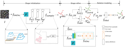
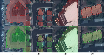
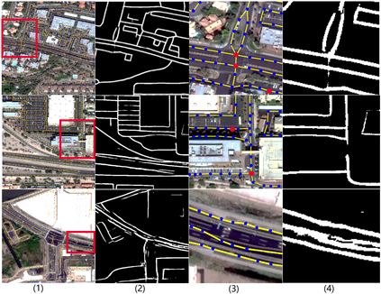
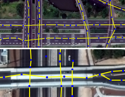
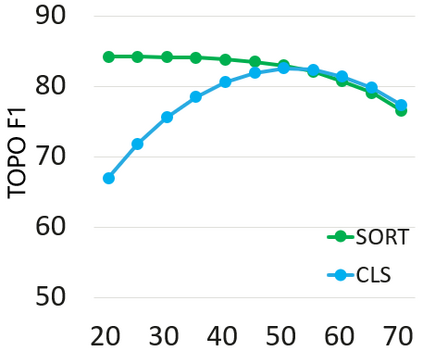
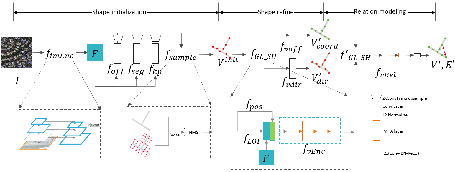
Large-scale vector mapping is important for transportation, city planning, and survey and census. We propose GraphMapper, a unified framework for end-to-end vector map extraction from satellite images. Our key idea is a novel unified representation of shapes of different topologies named "primitive graph", which is a set of shape primitives and their pairwise relationship matrix. Then, we convert vector shape prediction, regularization, and topology reconstruction into a unique primitive graph learning problem. Specifically, GraphMapper is a generic primitive graph learning network based on global shape context modelling through multi-head-attention. An embedding space sorting method is developed for accurate primitive relationship modelling. We empirically demonstrate the effectiveness of GraphMapper on two challenging mapping tasks, building footprint regularization and road network topology reconstruction. Our model outperforms state-of-the-art methods by 8-10% in both tasks on public benchmarks. All code will be publicly available.
翻译:大型矢量映射对于交通、城市规划以及测量和普查非常重要。 我们提议了GigapMapper, 这是一个从卫星图像中提取端到端矢量映射的统一框架。 我们的关键想法是新颖地统一代表不同地形的形状, 名为“原始图形 ”, 这是一套原始形状及其相配关系矩阵。 然后, 我们将矢量形状的预测、 正规化和地貌重建转换成一个独特的原始图学学习问题。 具体地说, GigapMapper 是一个通用的原始图学学习网络, 其基础是通过多头观察进行全球形状背景建模。 为精确原始关系建模开发了嵌入空间排序方法。 我们从经验上展示了图形Mapper在两项具有挑战性的绘图任务上的有效性, 即建立足迹定型和道路网络地貌重建。 我们的模型在公共基准的两项任务中都比最新设计的方法高出8- 10%。 所有代码都将公布。

