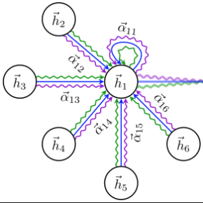
Sensors are the key to sensing the environment and imparting benefits to smart cities in many aspects, such as providing real-time air quality information throughout an urban area. However, a prerequisite is to obtain fine-grained knowledge of the environment. There is a limit to how many sensors can be installed in the physical world due to non-negligible expenses. In this paper, we propose to infer real-time information of any given location in a city based on historical and current observations from the available sensors (termed spatiotemporal inference). Our approach decouples the modeling of short-term and long-term patterns, relying on two major components. Firstly, unlike previous studies that separated the spatial and temporal relation learning, we introduce a joint spatiotemporal graph attention network that learns the short-term dependencies across both the spatial and temporal dimensions. Secondly, we propose an adaptive graph recurrent network with a time skip for capturing long-term patterns. The adaptive adjacency matrices are learned inductively first as the inputs of a recurrent network to learn dynamic dependencies. Experimental results on four public read-world datasets show that our method reduces state-of-the-art baseline mean absolute errors by 5%~12%.
翻译:感应器是在许多方面感测环境并给智能城市带来好处的关键,例如在整个城市地区提供实时空气质量信息。然而,一个先决条件是获得精细的环境知识。由于不可忽略的开支,在物理世界中安装多少感应器是有限度的。在本文中,我们提议根据现有感应器(长期的波长推断)提供的历史和当前观测结果,推断城市中任何特定地点的实时信息。我们的方法是分解短期和长期模式的模型,依靠两个主要组成部分。首先,与以往将空间和时间关系学习分开的研究不同,我们采用了一个联合波纹图注意网络,了解空间和时间两个层面的短期依赖性。第二,我们建议根据现有感应器(长期偏差)的历史和当前观测结果,推算出一个适应性图经常性网络,首先从一个经常网络的输入中学习动态依赖性。首先,我们通过四种公共读取的绝对值5 %的数据模型,实验性结果显示我们采用的方法降低了我们的方法。


