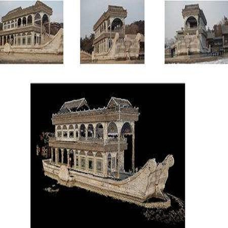
Autonomous UAV path planning for 3D reconstruction has been actively studied in various applications for high-quality 3D models. However, most existing works have adopted explore-then-exploit, prior-based or exploration-based strategies, demonstrating inefficiency with repeated flight and low autonomy. In this paper, we propose PredRecon, a prediction-boosted planning framework that can autonomously generate paths for high 3D reconstruction quality. We obtain inspiration from humans can roughly infer the complete construction structure from partial observation. Hence, we devise a surface prediction module (SPM) to predict the coarse complete surfaces of the target from the current partial reconstruction. Then, the uncovered surfaces are produced by online volumetric mapping waiting for observation by UAV. Lastly, a hierarchical planner plans motions for 3D reconstruction, which sequentially finds efficient global coverage paths, plans local paths for maximizing the performance of Multi-View Stereo (MVS), and generates smooth trajectories for image-pose pairs acquisition. We conduct benchmarks in the realistic simulator, which validates the performance of PredRecon compared with the classical and state-of-the-art methods. The open-source code is released at https://github.com/HKUST-Aerial-Robotics/PredRecon.
翻译:在高质量三维模型的各种应用中,对三维重建的自主无人驾驶飞行器路径规划进行了积极研究;然而,大多数现有工程都采用了探索-当时开发、先前基础或探索-基础战略,表明反复飞行和低自主效率低下;在本文件中,我们提出了PredRecon,这是一个预测-启动规划框架,可以自主为高三维重建质量创造路径;我们从人类获得灵感,可以从部分观察中大致推断完整的建筑结构;因此,我们设计了一个地表预测模块(SPM),以预测当前部分重建中目标的粗整表面;然后,通过在线体积图绘制未发现的表面,等待UAV的观察。最后,一个三级规划者计划动议,按顺序找到高效的全球覆盖路径,规划本地路径,以最大限度地提高多维重建质量的功能,并为获取图像配对生成平稳的轨迹。我们在现实的Simator中设置了基准,用以验证PredRecon公司与古典和州-REVI/Rustif-Ar-Restral 的代码。


