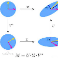
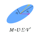
Autonomous driving systems are set to become a reality in transport systems and, so, maximum acceptance is being sought among users. Currently, the most advanced architectures require driver intervention when functional system failures or critical sensor operations take place, presenting problems related to driver state, distractions, fatigue, and other factors that prevent safe control. Therefore, this work presents a redundant, accurate, robust, and scalable LiDAR odometry system with fail-aware system features that can allow other systems to perform a safe stop manoeuvre without driver mediation. All odometry systems have drift error, making it difficult to use them for localisation tasks over extended periods. For this reason, the paper presents an accurate LiDAR odometry system with a fail-aware indicator. This indicator estimates a time window in which the system manages the localisation tasks appropriately. The odometry error is minimised by applying a dynamic 6-DoF model and fusing measures based on the Iterative Closest Points (ICP), environment feature extraction, and Singular Value Decomposition (SVD) methods. The obtained results are promising for two reasons: First, in the KITTI odometry data set, the ranking achieved by the proposed method is twelfth, considering only LiDAR-based methods, where its translation and rotation errors are 1.00% and 0.0041 deg/m, respectively. Second, the encouraging results of the fail-aware indicator demonstrate the safety of the proposed LiDAR odometry system. The results depict that, in order to achieve an accurate odometry system, complex models and measurement fusion techniques must be used to improve its behaviour. Furthermore, if an odometry system is to be used for redundant localisation features, it must integrate a fail-aware indicator for use in a safe manner.
翻译:自动驱动系统被设定为运输系统的现实,因此,正在寻求用户的最大接受度。目前,最先进的结构要求当发生功能系统故障或关键的传感器操作时进行驱动器干预,这提出了与驱动状态、分心、疲劳和妨碍安全控制的其他因素有关的问题。因此,这项工作呈现出一个冗余、准确、稳健和可缩放的LIDAR odo测量系统,该系统具有失识系统功能,可以让其他系统在没有驱动器调解的情况下进行安全停止操作。所有odo测量系统都存在漂移错误,因此难以将其用于长期的本地化任务。因此,本文展示了一个精确的LIDAR 测量系统,并带有不识性指标。 使用一个动态6-DoF模型和根据“透感性最接近点”(ICP)、环境特征提取和Singalultural Decomposition (SVD) 方法,获得的结果很有希望有两个原因:首先,在 KITTI od ogradual dismation 中,它使用一个正确的排序方法,它必须用一个安全性方法来证明它使用。


