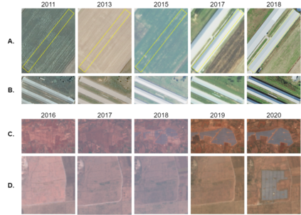
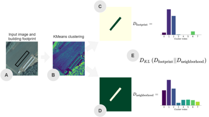
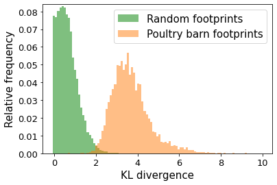
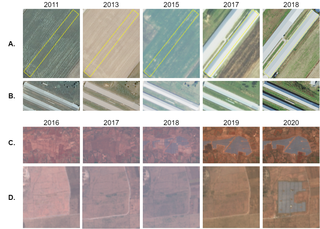
Longitudinal studies are vital to understanding dynamic changes of the planet, but labels (e.g., buildings, facilities, roads) are often available only for a single point in time. We propose a general model, Temporal Cluster Matching (TCM), for detecting building changes in time series of remotely sensed imagery when footprint labels are observed only once. The intuition behind the model is that the relationship between spectral values inside and outside of building's footprint will change when a building is constructed (or demolished). For instance, in rural settings, the pre-construction area may look similar to the surrounding environment until the building is constructed. Similarly, in urban settings, the pre-construction areas will look different from the surrounding environment until construction. We further propose a heuristic method for selecting the parameters of our model which allows it to be applied in novel settings without requiring data labeling efforts (to fit the parameters). We apply our model over a dataset of poultry barns from 2016/2017 high-resolution aerial imagery in the Delmarva Peninsula and a dataset of solar farms from a 2020 mosaic of Sentinel 2 imagery in India. Our results show that our model performs as well when fit using the proposed heuristic as it does when fit with labeled data, and further, that supervised versions of our model perform the best among all the baselines we test against. Finally, we show that our proposed approach can act as an effective data augmentation strategy -- it enables researchers to augment existing structure footprint labels along the time dimension and thus use imagery from multiple points in time to train deep learning models. We show that this improves the spatial generalization of such models when evaluated on the same change detection task.
翻译:纵向研究对于理解地球的动态变化至关重要, 但标签( 如建筑物、 设施、 道路等) 往往只为单一时间点提供。 我们提议了一个通用模型, 即时群群比匹配( TCM), 用于在仅观察一次足迹标签时探测遥感图像时间序列中的建筑变化。 模型背后的直觉是建筑物内外光谱值之间的关系在建筑物建造( 或拆除) 时会发生变化。 例如, 在农村环境中, 开工前地区可能看起来与周围环境相似, 直到建筑物建成。 同样, 在城市环境中, 开工前地区将看起来与周围环境不同, 直到建筑完成。 我们进一步提议采用一个超常模型, 用于在新环境中应用模型参数。 我们用模型模型模型在2016 - 2016 - 17 高分辨率的家禽谷仓库上应用我们的模型, 以及太阳能农场的数据集, 从2020 mosaisac labil 2 模型的深度检测到印度Sentinal II 的多重图像模型, 类似, 开工前地区将看起来与周围环境环境环境环境不同。 我们的建筑 的模型的模型显示我们所监督的精细化 的模型, 我们的模型 的模型的模型的模型 运行 显示我们所有模型 的模型 的模型的模型 运行 运行的模型 运行的模型 运行的模型 显示的模型的模型 的模型 的模型 的模型 的模型 运行 运行 运行 运行


