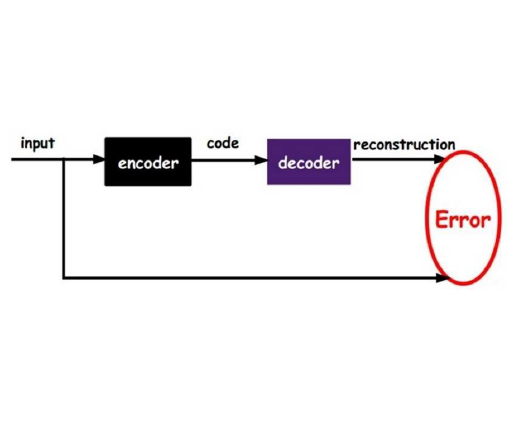
Explainable numerical representations or latent information of otherwise complex datasets are more convenient to analyze and study. These representations assist in identifying clusters and outliers, assess similar data points, and explore and interpolate data. Dataset of three-dimensional (3D) building models possesses inherent complexity in various footprint shapes, distinct roof types, walls, height, and volume. Traditionally, grouping similar buildings or 3D shapes requires matching their known properties and shape metrics with each other. However, this requires obtaining a plethora of such properties to calculate similarity. This study, in contrast, utilizes an autoencoder to compute the shape information in a fixed-size vector form that can be compared and grouped with the help of distance metrics. The study uses 'FoldingNet,' a 3D autoencoder, to generate the latent representation of each building from the obtained LoD 2 CityGML dataset. The efficacy of the embeddings obtained from the autoencoder is further analyzed by dataset reconstruction, latent spread visualization, and hierarchical clustering methods. While the clusters give an overall perspective of the type of build forms, they do not include geospatial information in the clustering. A geospatial model is therefore created to iteratively find the geographical groupings of buildings using cosine similarity approaches in embedding vectors. The German federal states of Brandenburg and Berlin are taken as an example to test the methodology. The output provides a detailed overview of the build forms in the form of semantic topological clusters and geographical groupings. This approach is beneficial and scalable for complex analytics, e.g., in large urban simulations, urban morphological studies, energy analysis, or evaluations of building stock.
翻译:暂无翻译


