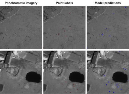
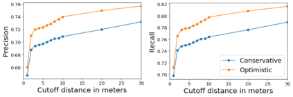
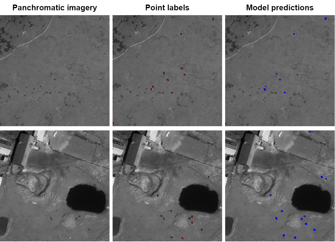
Localizing and counting large ungulates -- hoofed mammals like cows and elk -- in very high-resolution satellite imagery is an important task for supporting ecological studies. Prior work has shown that this is feasible with deep learning based methods and sub-meter multi-spectral satellite imagery. We extend this line of work by proposing a baseline method, CowNet, that simultaneously estimates the number of animals in an image (counts), as well as predicts their location at a pixel level (localizes). We also propose an methodology for evaluating such models on counting and localization tasks across large scenes that takes the uncertainty of noisy labels and the information needed by stakeholders in ecological monitoring tasks into account. Finally, we benchmark our baseline method with state of the art vision methods for counting objects in scenes. We specifically test the temporal generalization of the resulting models over a large landscape in Point Reyes Seashore, CA. We find that the LC-FCN model performs the best and achieves an average precision between 0.56 and 0.61 and an average recall between 0.78 and 0.92 over three held out test scenes.
翻译:在非常高分辨率的卫星图像中定位和计数大型蚂蚁 -- -- 如牛和 ⁇ 等哺乳动物 -- -- 是支持生态研究的一项重要任务。先前的工作表明,采用深层学习方法和次米多光谱卫星图像,这样做是可行的。我们通过提出基线方法CowNet,扩大这一工作线,同时估计图像中的动物数量(计数),并预测其位置的像素水平(本地化)。我们还提议了一种方法,用以评价在考虑生态监测任务利益攸关方所需信息的不确切性的大场景中计数和本地化任务模型。最后,我们把基线方法的基准与场景天体计数艺术视觉方法的状态作为基准。我们特别测试由此得出的模型在CA.A.C.C.C.F.C.CN模型在莱耶斯海滨的大型景观上的时间分布。我们发现,LC-FCN模型在0.56和0.61和平均回顾0.78和0.92之间,平均回顾在3个试验场外。


