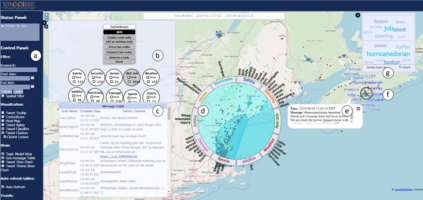
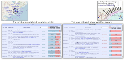
The first responder community has traditionally relied on calls from the public, officially-provided geographic information and maps for coordinating actions on the ground. The ubiquity of social media platforms created an opportunity for near real-time sensing of the situation (e.g. unfolding weather events or crises) through volunteered geographic information. In this article, we provide an overview of the design process and features of the Social Media Analytics Reporting Toolkit (SMART), a visual analytics platform developed at Purdue University for providing first responders with real-time situational awareness. We attribute its successful adoption by many first responders to its user-centered design, interactive (geo)visualizations and interactive machine learning, giving users control over analysis.
翻译:第一个应答者社区历来依靠公众发出的官方提供的地理信息和地图来协调实地行动,社交媒体平台的普遍存在通过自愿提供的地理信息,为近实时感知局势(例如正在发生的天气事件或危机)创造了机会,在本篇文章中,我们概述了社会媒体分析报告工具包的设计过程和特点,这是普鲁杜大学开发的一个视觉分析平台,向第一批应答者提供实时情况认识。我们把许多第一批应答者成功采用该工具归功于其用户中心设计、互动(地理)视频化和交互式机器学习,使用户能够控制分析。


