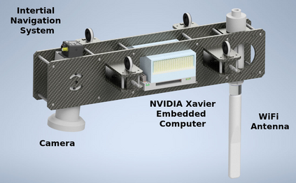
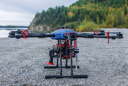
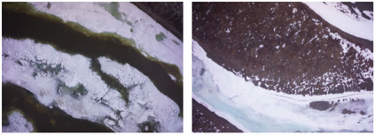
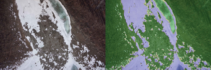
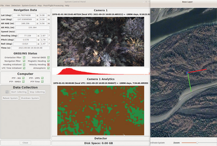
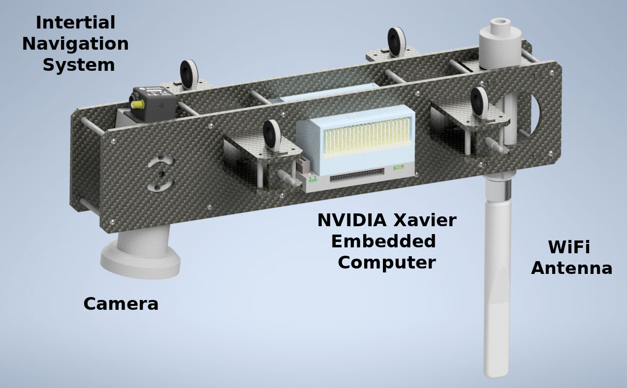
Small unmanned aircraft systems (sUAS) are becoming prominent components of many humanitarian assistance and disaster response (HADR) operations. Pairing sUAS with onboard artificial intelligence (AI) substantially extends their utility in covering larger areas with fewer support personnel. A variety of missions, such as search and rescue, assessing structural damage, and monitoring forest fires, floods, and chemical spills, can be supported simply by deploying the appropriate AI models. However, adoption by resource-constrained groups, such as local municipalities, regulatory agencies, and researchers, has been hampered by the lack of a cost-effective, readily-accessible baseline platform that can be adapted to their unique missions. To fill this gap, we have developed the free and open-source ADAPT multi-mission payload for deploying real-time AI and computer vision onboard a sUAS during local and beyond-line-of-site missions. We have emphasized a modular design with low-cost, readily-available components, open-source software, and thorough documentation (https://kitware.github.io/adapt/). The system integrates an inertial navigation system, high-resolution color camera, computer, and wireless downlink to process imagery and broadcast georegistered analytics back to a ground station. Our goal is to make it easy for the HADR community to build their own copies of the ADAPT payload and leverage the thousands of hours of engineering we have devoted to developing and testing. In this paper, we detail the development and testing of the ADAPT payload. We demonstrate the example mission of real-time, in-flight ice segmentation to monitor river ice state and provide timely predictions of catastrophic flooding events. We deploy a novel active learning workflow to annotate river ice imagery, train a real-time deep neural network for ice segmentation, and demonstrate operation in the field.
翻译:小型无人驾驶飞机系统(SUAS)正在成为许多人道主义援助和救灾行动的突出组成部分。对机载人工智能(AI)的SUAS进行净化,大大扩大其在更大的领域的效用,减少了支助人员。各种任务,如搜索和救援、评估结构破坏、监测森林火灾、洪水和化学泄漏,只要部署适当的AI模型就可以支持。然而,缺乏成本效益高、随时可获取的基线平台,无法适应其独特任务,使机载人工智能智能系统大大扩大其效用。各种任务,如搜索和救援、评估结构破坏、监测森林火灾、洪水和化学泄漏,只要部署适当的AI模型就可以支持。但缺乏资源限制的团体,如当地城市、监管机构和研究人员等,由于缺少一个成本效益高效益高效益的、随时可用的基线平台平台平台平台平台平台平台平台,因此,我们内部的惯性导航系统、高分辨率的AADAPT(ADAP)多任务,在当地和超线型飞行任务中部署实时AI和计算机;我们强调一个低成本的模块设计,用于实时的服务器和地面测试,我们不断进行实时的地面图像测试。我们向地面测试和地面图像的系统展示一个实时的系统,我们进行实时的实时的升级和实时的升级的升级和实时测试。我们向地面测试,一个实时的系统向地面站展示和地面测试,我们向地面的升级的服务器提供一个实时的升级的升级的升级的升级的升级的升级的系统,向地面测试,向地面测试,向地面测试。

