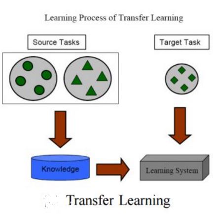
Bicycle-sharing systems (BSS) have become a daily reality for many citizens of larger, wealthier cities in developed regions. However, planning the layout of bicycle-sharing stations usually requires expensive data gathering, surveying travel behavior and trip modelling followed by station layout optimization. Many smaller cities and towns, especially in developing areas, may have difficulty financing such projects. Planning a BSS also takes a considerable amount of time. Yet as the pandemic has shown us, municipalities will face the need to adapt rapidly to mobility shifts, which include citizens leaving public transport for bicycles. Laying out a bike sharing system quickly will become critical in addressing the increase in bike demand. This paper addresses the problem of cost and time in BSS layout design and proposes a new solution to streamline and facilitate the process of such planning by using spatial embedding methods. Based only on publicly available data from OpenStreetMap, and station layouts from 34 cities in Europe, a method has been developed to divide cities into micro-regions using the Uber H3 discrete global grid system and to indicate regions where it is worth placing a station based on existing systems in different cities using transfer learning. The result of the work is a mechanism to support planners in their decision making when planning a station layout with a choice of reference cities.
翻译:发达区域较大、富裕城市的许多公民每天都要使用自行车共享系统(BSS),但是,在规划自行车共享站的布局时,通常需要昂贵的数据收集、调查旅行行为和旅行建模,然后优化车站布局。许多较小的城镇,特别是发展中地区的城镇,可能难以为此类项目提供资金。规划BSS还需要相当长的时间。然而,正如这一流行病向我们表明的那样,各城市将面临迅速适应流动性变化的需要,包括公民离开公共交通工具骑自行车。设置自行车共享系统对于解决自行车需求的增加将变得至关重要。本文解决了BSS布局设计的成本和时间问题,并提出了通过使用空间嵌入方法精简和促进这种规划过程的新解决方案。仅根据OpenStreeMap的公开数据和欧洲34个城市的站局布局,已经开发出一种方法,利用Uber H3离散全球电网系统将城市分为微型区域。在不同的城市现有系统上安装一个站点,在使用转移式设计模型进行规划时,其规划的结果是其决策结构的一种机制。


