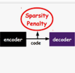
This paper addresses the land cover classification task for remote sensing images by deep self-taught learning. Our self-taught learning approach learns suitable feature representations of the input data using sparse representation and undercomplete dictionary learning. We propose a deep learning framework which extracts representations in multiple layers and use the output of the deepest layer as input to a classification algorithm. We evaluate our approach using a multispectral Landsat 5 TM image of a study area in the North of Novo Progresso (South America) and the Zurich Summer Data Set provided by the University of Zurich. Experiments indicate that features learned by a deep self-taught learning framework can be used for classification and improve the results compared to classification results using the original feature representation.
翻译:本文论述通过深层自学的遥感图像的土地覆盖分类任务。我们的自学学习方法利用稀少的表述和不完整的字典学习来学习输入数据的适当特征。我们提出了一个深层学习框架,在多层中提取表述,并将最深层的输出作为分类算法的投入。我们使用新进步(南美洲)北部一个研究区的多光谱大地卫星5TM图像和苏黎世大学提供的苏黎世夏季数据集来评估我们的方法。实验表明,通过深层自学学习框架学习的特征可以用于分类,并用原始特征表示来改进结果与分类结果的比较。


