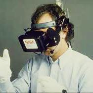
The use of head-mounted display technologies for virtual reality experiences is inherently single-user-centred, allowing for the visual immersion of its user in the computer-generated environment. This isolates them from their physical surroundings, effectively preventing external visual information cues, such as the pointing and referral to an artifact by another user. However, such input is important and desired in collaborative scenarios when exploring and analyzing data in virtual environments together with a peer. In this article, we investigate different designs for making spatio-temporal references, i.e., visually highlighting virtual data artifacts, within the context of Collaborative Immersive Analytics. The ability to make references to data is foundational for collaboration, affecting aspects such as awareness, attention, and common ground. Based on three design options, we implemented a variety of approaches to make spatial and temporal references in an immersive virtual reality environment that featured abstract visualization of spatio-temporal data as 3D Radar Charts. We conducted a user study (n=12) to empirically evaluate aspects such as aesthetic appeal, legibility, and general user preference. The results indicate a unified favour for the presented location approach as a spatial reference while revealing trends towards a preference of mixed temporal reference approaches dependent on the task configuration: pointer for elementary, and outline for synoptic references. Based on immersive data visualization complexity as well as task reference configuration, we argue that it can be beneficial to explore multiple reference approaches as collaborative information cues, as opposed to following a rather uniform user interface design.
翻译:在虚拟现实经验中,头顶显示技术的使用本质上以单一用户为中心,允许用户在计算机生成的环境中以视觉方式沉浸在计算机生成的环境中,从而将用户与物理环境隔离开来,有效防止外部视觉信息提示,如指点和由另一个用户介绍文物等。然而,在探索和分析虚拟环境中的数据时,这种投入在合作情景中很重要,而且与同行一起在探索和分析虚拟现实环境中的数据时也是可取的。在本篇文章中,我们调查了制作时空引用的不同设计,即在协作光线分析分析分析环境中,直观地显示虚拟数据制品。 引用数据的能力是合作的基础,影响到认识、关注和共同地面等各个方面。基于三个设计选项,我们采用了各种办法,在以抽象的视觉虚拟现实环境中,即3D 雷达图中,对磁带-时空数据进行可视化引用。我们开展了一项用户研究(n=12),对诸如审美性吸引力、可辨度参考度和一般用户参考度等方面进行实证性评估。 以图像设计为基准,结果显示一个统一的空间定位,同时展示方向,作为基础任务定位,以展示方向,以展示方向,并展示基础任务定位。</s>


