High resolution data models like grid terrain models made from LiDAR data are a prerequisite for modern day Geographic Information Systems applications. Besides providing the foundation for the very accurate digital terrain models, LiDAR data is also extensively used to classify which parts of the considered surface comprise relevant elements like water, buildings and vegetation. In this paper we consider the problem of classifying which areas of a given surface are fortified by for instance, roads, sidewalks, parking spaces, paved driveways and terraces. We consider using LiDAR data and orthophotos, combined and alone, to show how well the modern machine learning algorithms Gradient Boosted Trees and Convolutional Neural Networks are able to detect fortified areas on large real world data. The LiDAR data features, in particular the intensity feature that measures the signal strength of the return, that we consider in this project are heavily dependent on the actual LiDAR sensor that made the measurement. This is highly problematic, in particular for the generalisation capability of pattern matching algorithms, as this means that data features for test data may be very different from the data the model is trained on. We propose an algorithmic solution to this problem by designing a neural net embedding architecture that transforms data from all the different sensor systems into a new common representation that works as well as if the training data and test data originated from the same sensor. The final algorithm result has an accuracy above 96 percent, and an AUC score above 0.99.
翻译:高分辨率数据模型,如从LIDAR数据中生成的网格地形模型等高分辨率数据模型,是现代地理信息系统应用的先决条件。除了为非常精确的数字地形模型提供基础外,LIDAR数据还被广泛用于分类被视为表面的哪些部分包括水、建筑物和植被等相关要素。在本文中,我们考虑对某一表面的哪些区域进行分类的问题,例如,道路、人行道、停车位、铺面车道和梯度。我们认为,使用LIDAR数据和正方形相匹配算法是现代地理信息系统的一个先决条件。除了为非常精确的数字地形模型提供基础外,LIDAR数据还被广泛用于分类。LIDAR数据特征,特别是测量某一表层的强度特征,例如道路、人行道、车道、停车空间、铺面车道和梯度等。我们认为,这非常有问题,特别是模式匹配算法的通用能力,因为这意味着用于测试数据比例的数据特征可能比重更高,比重的树木和动态神经网络网络网络网络网络网络网络能探测到一个数据模型,因此,我们建议通过新的数据算算法将数据模型进行新的数据测试,从而将数据转换成一个不同的数据模型。
相关内容
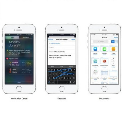
- Today (iOS and OS X): widgets for the Today view of Notification Center
- Share (iOS and OS X): post content to web services or share content with others
- Actions (iOS and OS X): app extensions to view or manipulate inside another app
- Photo Editing (iOS): edit a photo or video in Apple's Photos app with extensions from a third-party apps
- Finder Sync (OS X): remote file storage in the Finder with support for Finder content annotation
- Storage Provider (iOS): an interface between files inside an app and other apps on a user's device
- Custom Keyboard (iOS): system-wide alternative keyboards
Source: iOS 8 Extensions: Apple’s Plan for a Powerful App Ecosystem


